
STAGE 4
Langavatn – Kjerag – Lysebotn

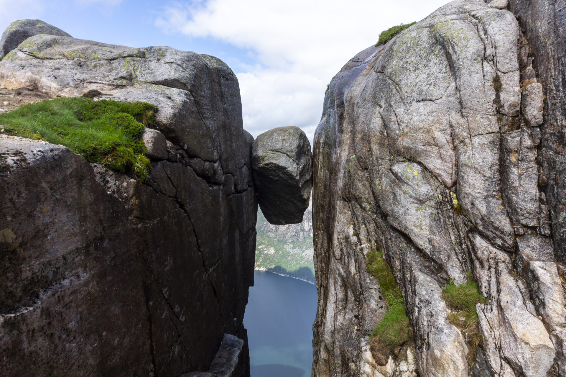


Kjeragbolten, also called «Majesty of the Lysefjord», is wedged 984 meters above sea level. Standing on the boulder provides a real adrenaline kick, but nature along the trail is so spectacular, that the rock information itself is only one of the highlights. From Langavatn, the trip first goes over bare rock, before you reach the edge of the mountain plateau, overlooking the fjord, providing both horizontal and vertical vistas. Having finished this stage, you have come all the way to the end of the fjord – the cozy town of Lysebotn is surrounded by mighty mountain walls. Here you can frolic in three-course dinners, take a wonderful shower and sleep in soft beds, before heading off hiking the north side of the Lysefjord.
We recommend to hike the Lysefjorden Rundt Trail anti-clockwise. The information on this page is based on hiking west-east. However, it is possible to hike this stage in both directions.
![]() On ut.no, Norway’s hiking planner, you’ll find detailed trail information. Use digital maps for navigation, and searching for cabins and hikes all over the country. Ut.no is a services offered to the public by the Norwegian Trekking Association (DNT).
On ut.no, Norway’s hiking planner, you’ll find detailed trail information. Use digital maps for navigation, and searching for cabins and hikes all over the country. Ut.no is a services offered to the public by the Norwegian Trekking Association (DNT).

| Difficulty | Demanding |
| Distance | 12.5 km |
| Duration | 7-8 hours (south-north) 8-9 hours (north-south) |
| Total elevation gain | 550 meter (south-north) 850 meter (north-south) |
| Season | July – October |
| Link to digital hiking map | Ut.no/langavatn-kjerag-øygardstøl |
| GPX-file | Langavatn-Kjerag-Øygardstøl (GPX) |
| More info |
Directions
There are no roads to Langavatn. When coming from the west, you first have to hike from Flørli. See Flørli-Langavatn.
When starting at Øygardstøl, you can park at the trail head. From Stavanger, the fastest and easiest route is to drive around the mountains, via Sirdal and over the mountain pass (Lysevegen) to Øygardstøl (about 2.5 hours). However, you can also take the car on the ferry to Lysebotn, from Lauvvik, Forsand and Songesand.
The ferries have limited capacity and you need to book in advance (see Public Transport).
The road to Øygardstøl is closed from November to Mid-May due to snow conditions.
The parking fee at Øygardstøl is 250 kroner. Talk with the parking attendants if you wish to leave your car overnight.
Public Transport
There is no public transportation to Langavatn. When coming from the west, you first have to hike from Flørli. See Flørli-Langavatn.
Lysebotn
Kolumbus – speed ferry
Ferry departures from/to Lauvvik, Forsand, Songesand and Flørli to/from Lysebotn (year-round).
SBK Base
Shuttle bus Lysebotn – Øygardstøl.
Kjerag Ekspress Buss
From Stavanger.
Accommodation
Are you planning to hike the Lysefjorden Rundt Trail in 2026?
By registering and sharing your schedule, you enable us to offer you free personalized advice on the feasibility of your hiking itinerary, considering both difficulty and logistics. It also provides us with data on visitor traffic and trail usage, which helps us make targeted improvements.
After your hike, you will receive a feedback form. We encourage you to share your experiences, as this information is vital for us to improve both the trail and the overall visitor experience continuously.
Lysefjord visitor guide
As you experience this majestic landscape, remember that your actions hold the power to protect and celebrate our unique destination for all who follow in your footsteps.

Respect Nature

Be Part of the Local Community

Stay Safe
