LYSEFJORD PANORAMA TRAIL
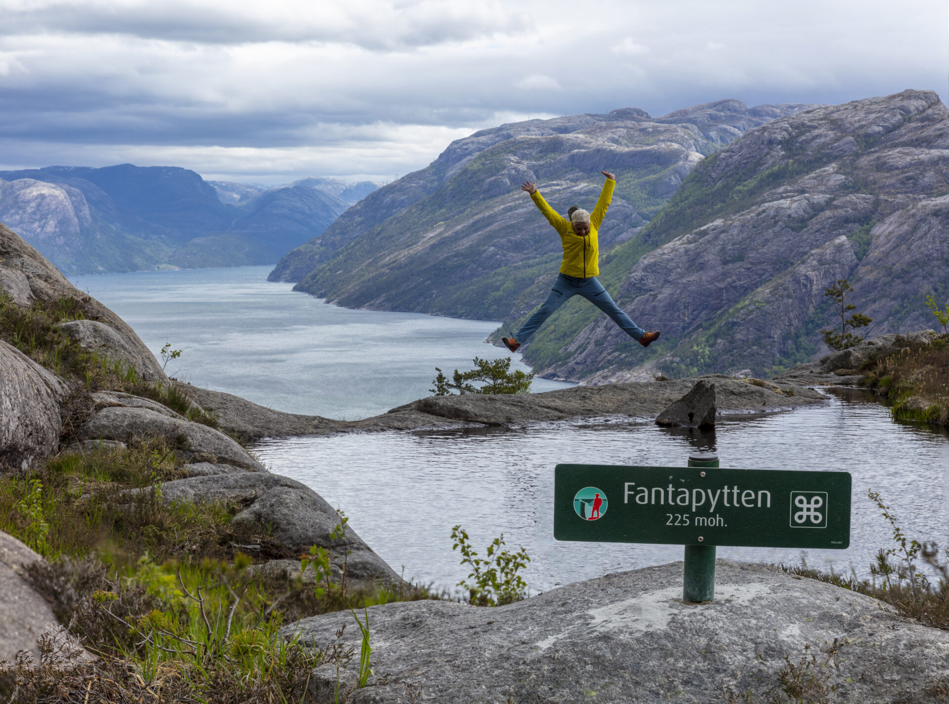
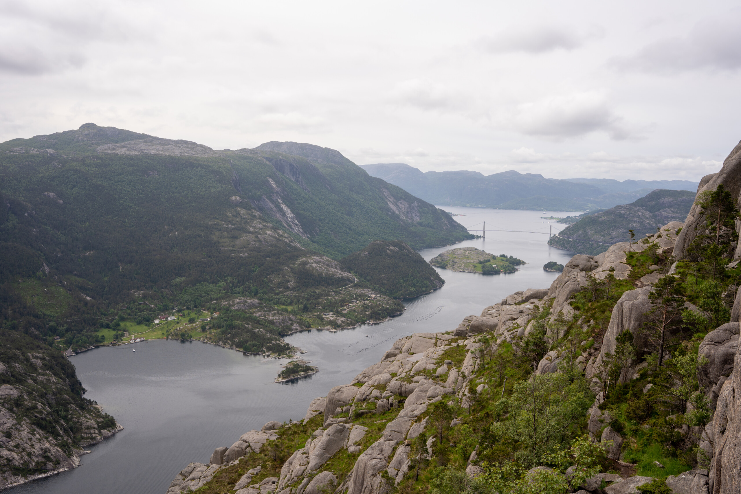
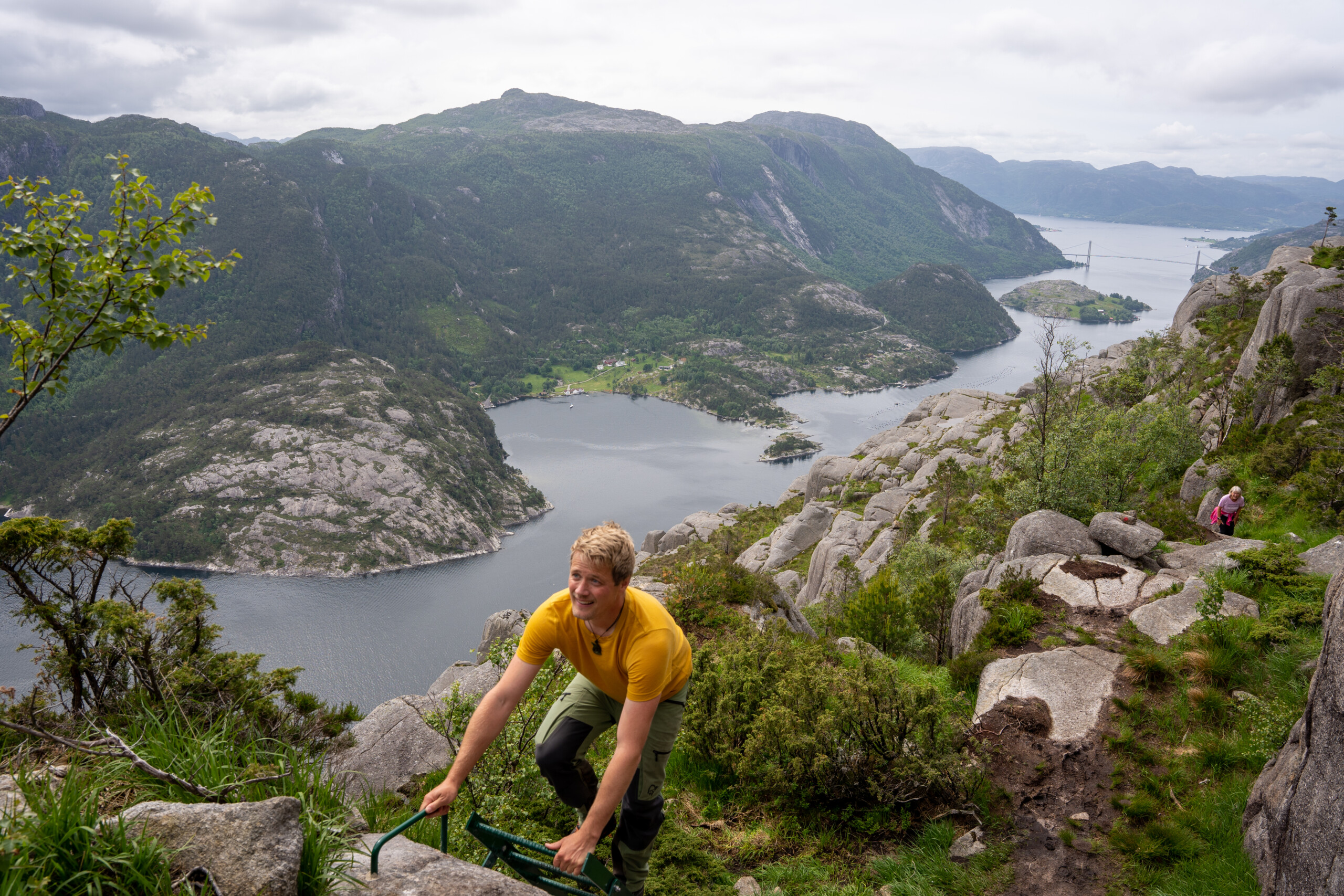
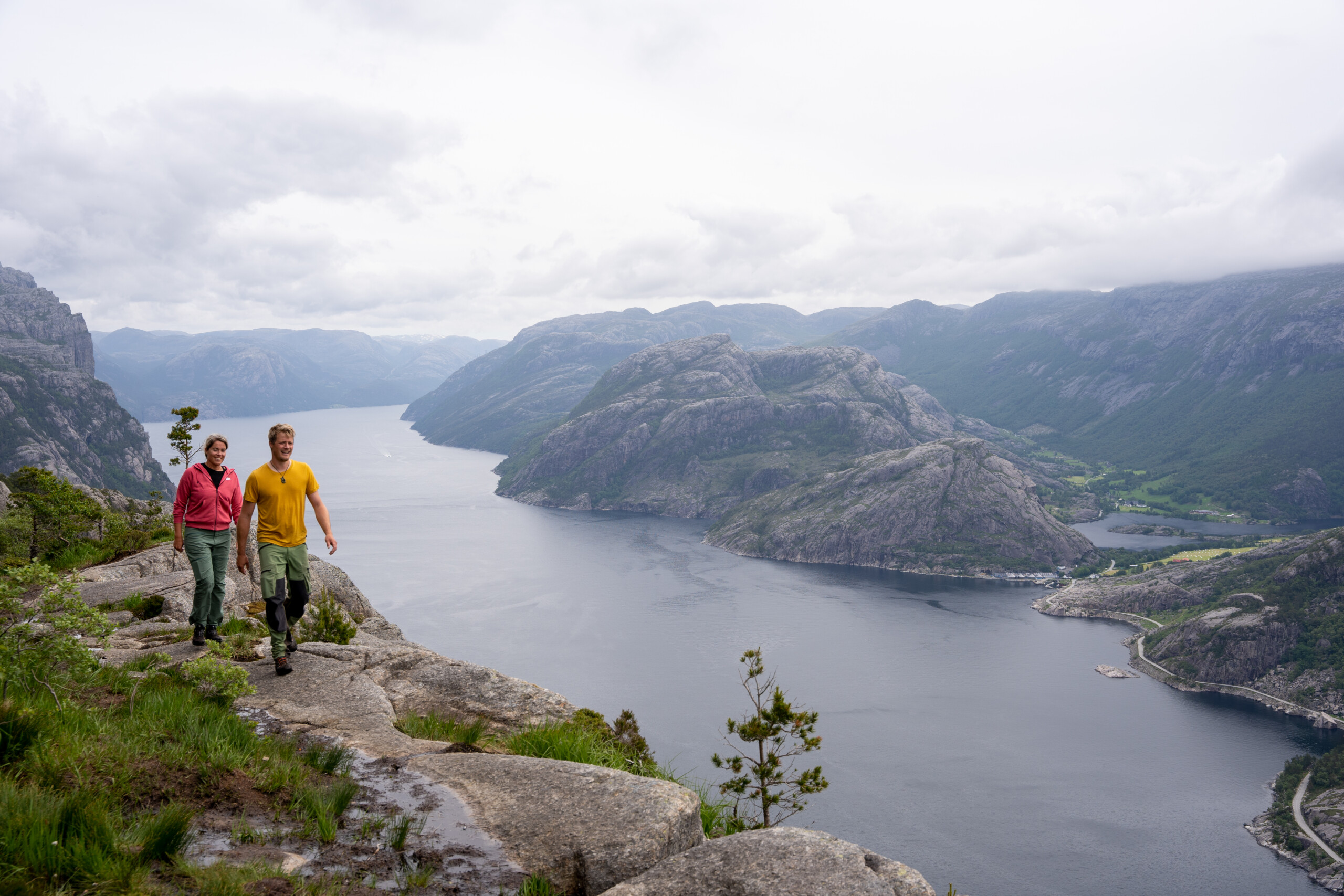
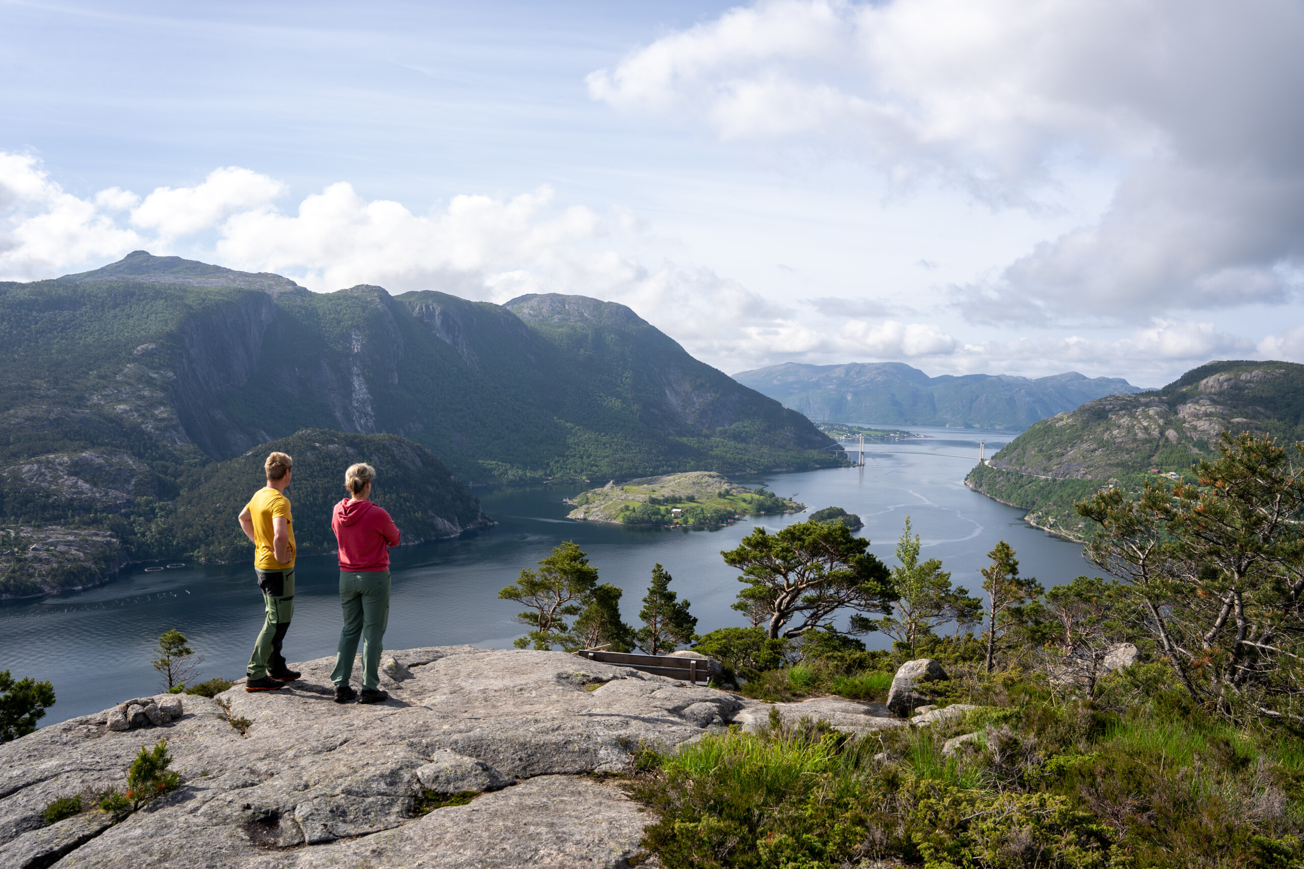


Deze wandeling zal je de adem benemen! Als je maar één wandeling in de omgeving van Lysefjord kunt kiezen, dan is dit gloednieuwe pad absoluut een serieuze concurrent voor Preikestolen. Route 75% loopt vlak langs de fjord. Enkele honderden meters boven zeeniveau slingert het pad langs verschillende bergkliffen en kloven, waaronder Skjerajuvet en Fantahålå – door adembenemende landschappen langs talloze panoramische uitzichtpunten. Als je goed oplet, ontdek je de prachtige Fantapytten – het eigen 'infinity pool' van Lysefjord.
Neem een bus vanaf de parkeerplaats Preikestolen naar het beginpunt van de wandelroute bij Høllesliheia / The Bolder en wandel de hele route A–B, zodat u niet heen en weer hoeft te lopen of logistiek hoeft te regelen.
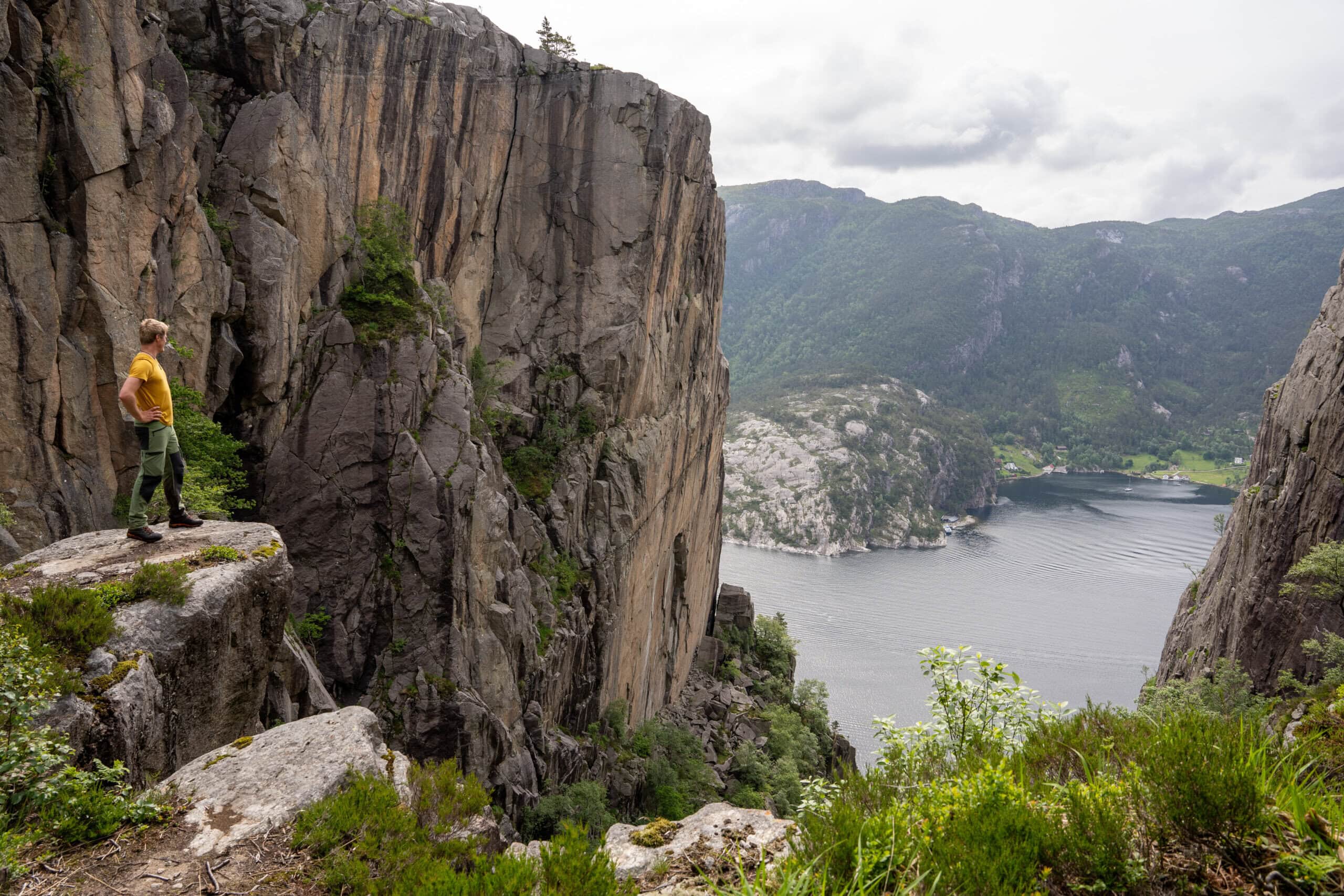
Dit is een pittige wandeling. Vanaf het begin is het terrein bergachtig, met veel kleine stijgingen en dalingen, terwijl het pad zich slingert langs verschillende kliffen, kleine kloven en rotsformaties. Er zijn enkele onbeschutte stukken. Vóór de kloof Skjerajuvet beklim je een korte, maar steile heuvel met een telefoonmast op de top. De diepe en fotogenieke Skjerajuvet is zeker een korte pauze waard, voordat je nieuwe hellingen opgaat richting de berg Hatten.
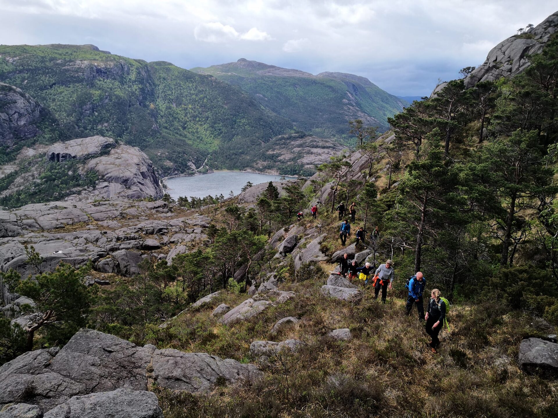
Voorbij Hatten loopt het pad bergafwaarts langs een oude, met steenhoopjes gemarkeerde route. Hier is het terrein een stuk minder steil, waardoor je kunt genieten van het uitzicht op de Lysefjord, die zich in al zijn glorie voor je uitstrekt. Vlak voordat je een bergplateau bereikt bij Fantahålå, duikt het pad naar beneden door een sprookjesachtige beboste helling genaamd Lausefjell. De volgende bezienswaardigheid is "Fantapytten" – een ondiepe plas met een adembenemend uitzicht op de Lysefjord. Vanuit de juiste hoek lijkt de vijver op een "infinity pool". Je krijgt gegarandeerd veel likes met een foto van jezelf terwijl je baadt en geniet van het fjorduitzicht.
Vanaf hier buigt het pad af van de Lysefjord. Na een flinke klim passeert het pad een uitkijkpunt vanwaar je recht naar beneden kunt kijken, de baai van Fantahålå in. Met een beetje geluk kun je zwaaien naar de passagiers van de toeristenboten die deze legendarische plek bezoeken.
Na een paar kilometer door een weelderig bos leidt het pad naar het prachtige Revsvatnet-meer. Op de morenen aan het einde van het meer ligt de voormalige Vatne-boerderij, nu Preikestolen BaseCamp. Een perfecte plek om te genieten van een welverdiend diner na een pittige maar lonende wandeling!

| Moeilijkheid | Veeleisend |
| Afstand | 9 km (A→B) |
| Duur | 4-5 uur |
| Totale hoogteverschil | 600 |
| Seizoen | april – oktober |
| Link naar wandelkaart | ut.no/preikestolen-basecamp-høllesliheia |
| GPX-bestand | Høllesliheia-Preikestolen BaseCamp (GPX) |

Routebeschrijving en parkeren
Voor de beste ervaring raden we ten zeerste aan om de wandeling te starten bij Høllesliheia/The Bolder en te eindigen bij de parkeerplaats Preikestolen. Zo geniet je van de mooiste uitzichten en wandel je de steilste stukken omhoog en de minder steile stukken omlaag.
We raden aan te parkeren bij Preikestolen Parking, vervoer naar Høllesliheia/The Bolder te regelen en terug te wandelen naar Preikestolen Parking. Zo voorkom je dat je dezelfde route twee keer loopt.
Je kunt met de auto rijden of de bus nemen van Stavanger naar de parkeerplaats van Preikestolen. Vanaf daar kun je een bus nemen naar het beginpunt van de wandelroute (zie Openbaar vervoer).
Als u liever parkeert bij Høllesliheia / The Bolder, houd er dan rekening mee dat er geen toiletvoorzieningen zijn. Volg en respecteer alle lokale borden en aanwijzingen.
Openbaar vervoer
Busshuttle van Preikestolen Parking naar Høllesliheia / The Bolder (trailhead)
Nieuw in 2026
- Mei-september: Dagelijkse busvertrek om 11:00 van Preikestolen Parking naar Høllesliheia / The Bolder
- Oktober: Weekendvertrekken bij 12:00
- Rijtijd: ongeveer 15 minuten
- Prijs: NOK 70
Boeking: Preekstoelrots-rondleidingen
Selecteer bij het boeken “Van: Pulpit Rock” en “Naar: The Bolder.”
Preikestolen Ekspress Bus of Preekstoelrots-rondleidingen
Voor vervoer tussen Stavanger / Jørpeland en Preikestolen Parking.
Strandtaxi
Voor privévervoer tussen Preikestolen Basecamp en The Bolder.
Veerboten op de Lysefjord
Vertrek vanuit Lysebotn, Songesand en Flørli naar Forsand. (hele jaar)
Gids voor bezoekers van Lysefjord
Terwijl u dit majestueuze landschap verkent, bedenk dan dat uw daden de kracht hebben om onze unieke bestemming te beschermen en te koesteren voor iedereen die in uw voetsporen treedt.

Respecteer de natuur

Maak deel uit van de lokale gemeenschap

Let op je veiligheid
