
ETAPA 3
Flørli – Langavatn

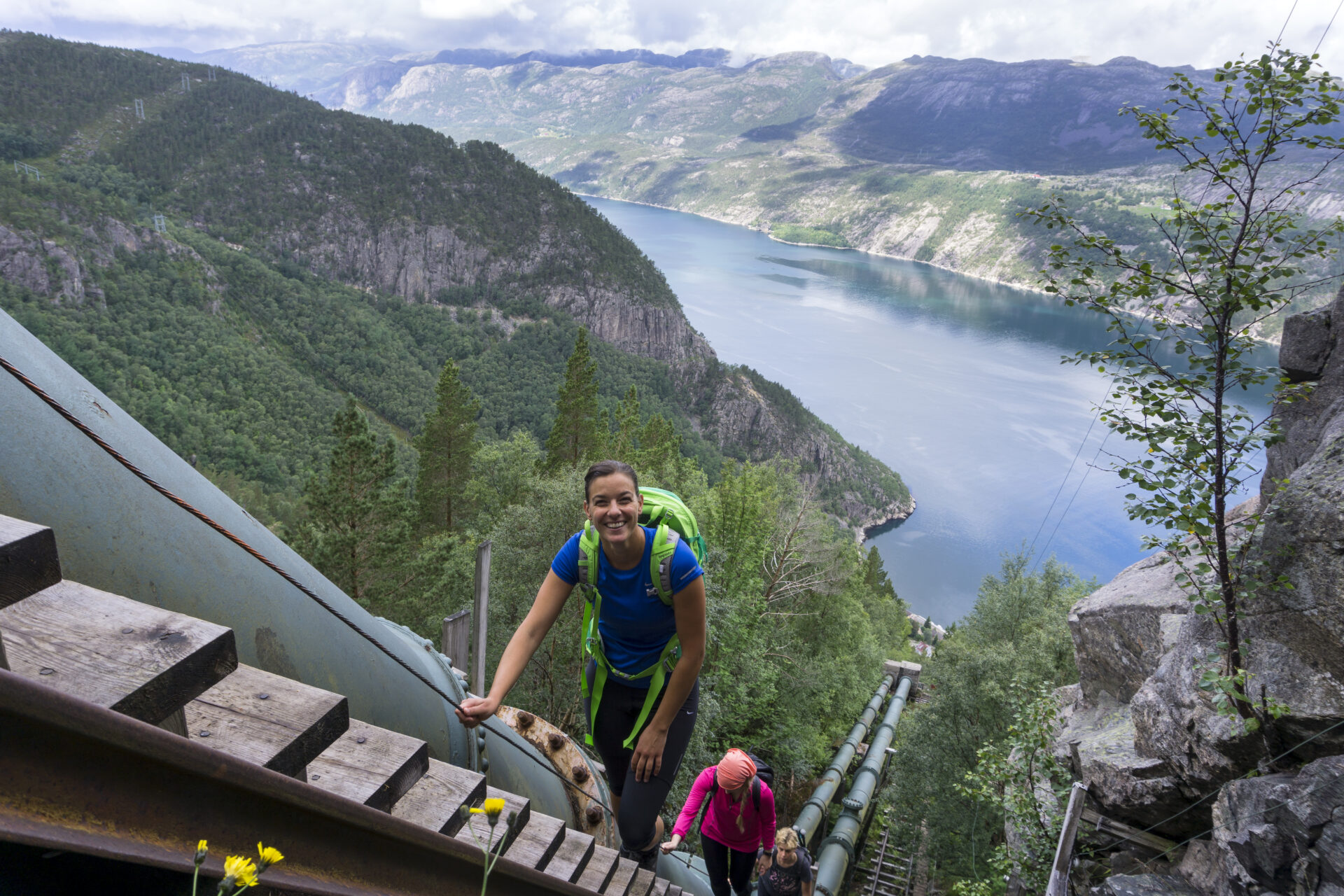


Subir la escalera de madera más larga del mundo es una experiencia inolvidable. 4444 escalones te llevarán desde el fiordo hasta los 742 metros sobre el nivel del mar en tan solo 2 km, ofreciendo impresionantes vistas del fiordo Lysefjord y del pueblo de Flørli. De repente, te encuentras en las montañas. Es una caminata muy larga hasta Langavatn. ¡Empieza temprano y prepárate para un gran desnivel! El sendero atraviesa un terreno muy variado: lechos rocosos expuestos, salpicados de cantos rodados de la última glaciación, pantanos y estanques. Esta desafiante caminata ofrece una auténtica experiencia en plena naturaleza. La mayoría de los senderistas subestiman la dificultad. Prepárese bien, ya que puede durar hasta 15 horas. Si hace mal tiempo, recomendamos una excursión de un día en Flørli para evitar riesgos innecesarios en este exigente sendero.
Recomendamos recorrer el sendero Lysefjorden Rundt en sentido contrario a las agujas del reloj. La información de esta página se basa en una ruta de oeste a este. Comience la ruta antes de las 9:00 h. En junio, consulte el estado de la nieve. Al recorrer la ruta de este a oeste, no baje las empinadas escaleras de Flørli. Desde lo alto de las escaleras de Flørli, puede descender por el sendero Rallarstien, que es más seguro.
![]() En ut.no, el planificador de senderismo de Noruega, encontrarás información detallada sobre rutas. Usa mapas digitales para navegar y buscar cabañas y rutas de senderismo por todo el país. ut.no es un servicio público de la Asociación Noruega de Senderismo (DNT).
En ut.no, el planificador de senderismo de Noruega, encontrarás información detallada sobre rutas. Usa mapas digitales para navegar y buscar cabañas y rutas de senderismo por todo el país. ut.no es un servicio público de la Asociación Noruega de Senderismo (DNT).

| Dificultad | MUY EXIGENTE (oeste-este) Demandante (este-oeste) |
| Distancia | 17 km (oeste) |
| Duración | De 8 a 10 horas (de oeste a este) para senderistas experimentados. No es raro emplear hasta 15 horas en el sendero. 7-9 horas (de este a oeste) para excursionistas experimentados. Empezar no más tarde de las 8am. |
| Ganancia de elevación total | 1600 (oeste-este) 550 (este-oeste) |
| Estación | Julio – octubre |
| Enlace al mapa digital de senderismo | Ut.no/flørli-langavatn |
| Archivo GPX | Flørli-Langavatn (GPX) |
| Más información |
Instrucciones
Puedes tomar una transportar a Florli. No hay carreteras hacia Flørli. Aparca en los muelles de Lauvvik, Forsand, Songesand o Lysebotn.
Si caminas desde Langavatn, primero tienes que caminar desde Øygardstøl. Ver Langavatn-Kjerag-Lysebotn.
Transporte público
Puedes tomar una transportar a Flørli desde Lauvvik, Forsand, Bratteli, Bakken, Songesand y Lysebotn.
Si caminas desde Langavatn, primero tienes que caminar desde Øygardstøl. Ver Langavatn-Kjerag-Lysebotn.
Alojamiento
¿Estás planeando recorrer el Lysefjorden Rundt Trail en 2026?
Al registrarte y compartir tu horario, nos permites ofrecerte asesoramiento personalizado gratuito sobre la viabilidad de su itinerario de senderismo, considerando tanto la dificultad como la logística. También nos proporciona datos sobre el tráfico de visitantes y el uso de los senderos, lo que nos ayuda a implementar mejoras específicas.
Después de su caminata, recibirá un formulario de comentarios. Le animamos a compartir sus experiencias, ya que esta información es vital para que podamos mejorar continuamente tanto el sendero como la experiencia general de los visitantes.
Guía turística del fiordo de Lysefjord
Mientras experimenta este majestuoso paisaje, recuerde que sus acciones tienen el poder de proteger y celebrar nuestro destino único para todos los que siguen sus pasos.

Respetar la naturaleza

Sea parte de la comunidad local

Mantenerse seguro
