
STUFE 3
Flørli – Langavatn

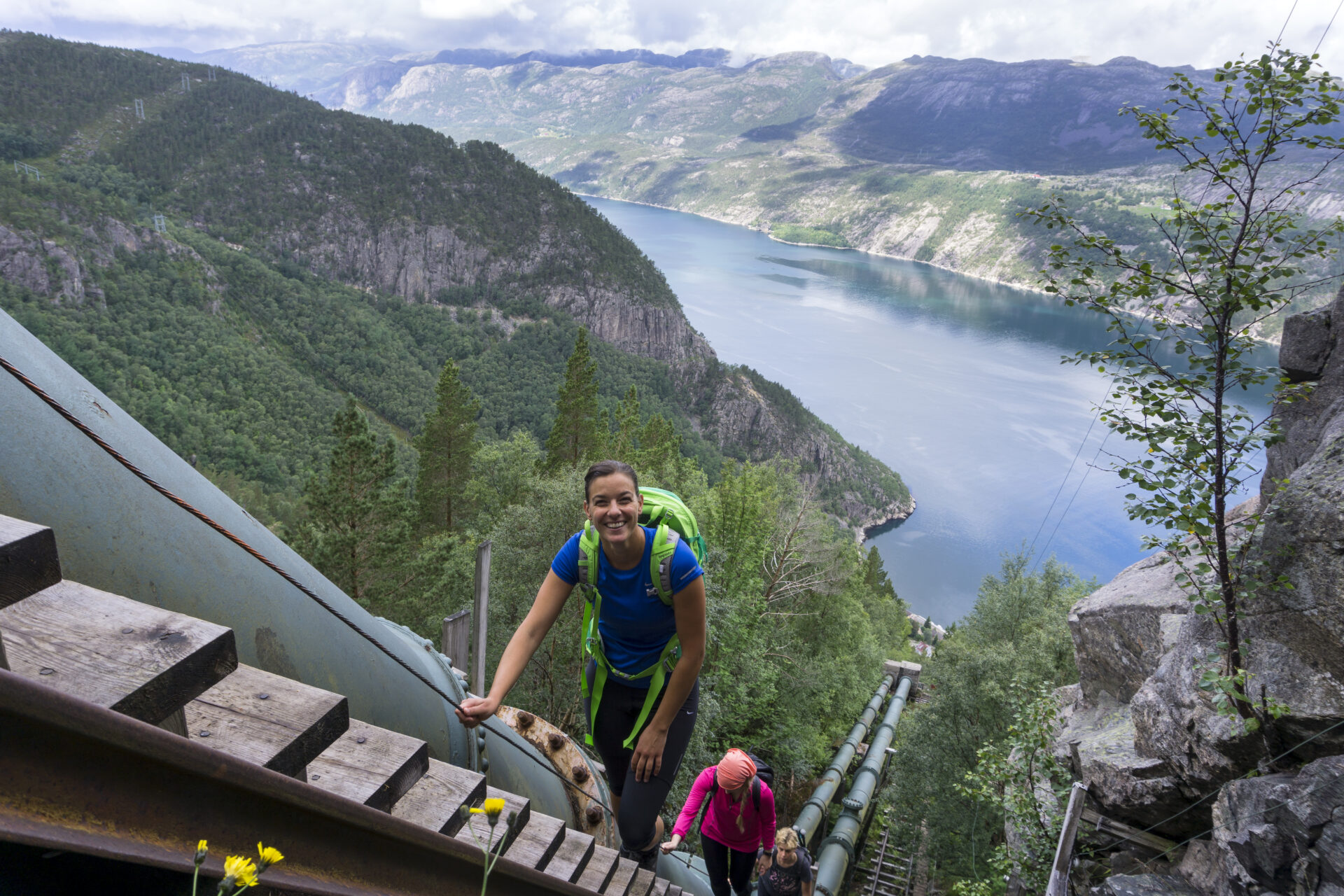


Die Wanderung über die längste Holztreppe der Welt ist ein unvergessliches Erlebnis. 4.444 Stufen führen Sie vom Fjord hinauf auf 742 Meter über dem Meeresspiegel – in nur 2 km Länge. Unterwegs genießen Sie atemberaubende Ausblicke auf den Lysefjord und das Dorf Flørli. Plötzlich befinden Sie sich in den Bergen. Die Wanderung nach Langavatn ist sehr lang. Starten Sie früh und stellen Sie sich auf einen steilen Anstieg ein! Der Weg führt durch abwechslungsreiches Gelände: freiliegendes Gestein, übersät mit Felsbrocken aus der letzten Eiszeit, Moore und Teiche. Diese anspruchsvolle Wanderung bietet ein authentisches Wildniserlebnis. Die meisten Wanderer unterschätzen ihren Schwierigkeitsgrad. Seien Sie gut vorbereitet, da die Tour bis zu 15 Stunden dauern kann. Bei schlechtem Wetter empfehlen wir eine Tageswanderung in Flørli, um unnötige Risiken auf diesem anspruchsvollen Pfad zu vermeiden.
Wir empfehlen, den Lysefjorden Rundt Trail gegen den Uhrzeigersinn zu wandern. Die Informationen auf dieser Seite beziehen sich auf eine Wanderung von West nach Ost. Beginnen Sie die Wanderung spätestens um 9 Uhr. Im Juni sollten Sie die Schneeverhältnisse prüfen. Bei einer Wanderung von Ost nach West sollten Sie die steile Flørli-Treppe nicht hinuntergehen. Vom oberen Ende der Flørli-Treppe können Sie den sichereren Rallarstien Trail hinabwandern.
![]() Auf ut.no, Norwegens Wanderplaner, finden Sie detaillierte Informationen zu Wanderwegen. Nutzen Sie digitale Karten zur Navigation und zur Suche nach Hütten und Wanderungen im ganzen Land. Ut.no ist ein Service des Norwegischen Wandervereins (DNT).
Auf ut.no, Norwegens Wanderplaner, finden Sie detaillierte Informationen zu Wanderwegen. Nutzen Sie digitale Karten zur Navigation und zur Suche nach Hütten und Wanderungen im ganzen Land. Ut.no ist ein Service des Norwegischen Wandervereins (DNT).

| Schwierigkeit | SEHR ANSPRUCHSVOLL (West-Ost) Anspruchsvoll (Ost-West) |
| Distanz | 17 km (West-Ost) |
| Dauer | 8–10 Stunden (West-Ost) für erfahrene Wanderer. Es ist nicht ungewöhnlich, bis zu 15 Stunden für die Wanderung zu benötigen. 7-9 Stunden (Ost-West) für geübte Wanderer. Beginnen Sie spätestens um 8 Uhr. |
| Gesamter Höhengewinn | 1600 (West-Ost) 550 (Ost-West) |
| Jahreszeit | Juli – Oktober |
| Link zur digitalen Wanderkarte | Ut.no/flørli-langavatn |
| GPX-Datei | Flørli-Langavatn (GPX) |
| Mehr Infos |
Wegbeschreibung
Sie können ein Fähre nach Flørli. Es gibt keine Straßen nach Flørli. Parken Sie am Kai Lauvvik, Forsand, Songesand oder Lysebotn.
Wer von Langavatn aus wandern möchte, muss zuerst von Øygardstøl aus wandern. Siehe Langavatn-Kjerag-Lysebotn.
Öffentliche Verkehrsmittel
Sie können ein Fähre nach Flørli von Lauvvik, Forsand, Bratteli, Bakken, Songesand und Lysebotn.
Wer von Langavatn aus wandern möchte, muss zuerst von Øygardstøl aus wandern. Siehe Langavatn-Kjerag-Lysebotn.
Unterkunft
Planen Sie, den Lysefjorden Rundt Trail im Jahr 2026 zu wandern?
Indem Sie sich registrieren und Ihren Zeitplan teilen, ermöglichen Sie uns, Ihnen Folgendes anzubieten: kostenlose individuelle Beratung Wir prüfen die Machbarkeit Ihrer Wanderroute unter Berücksichtigung von Schwierigkeitsgrad und Logistik. Außerdem erhalten wir Daten zum Besucheraufkommen und zur Wegenutzung, die uns helfen, gezielte Verbesserungen vorzunehmen.
Nach Ihrer Wanderung erhalten Sie einen Feedbackbogen. Wir freuen uns über Ihre Rückmeldung, da diese Informationen für uns unerlässlich sind, um sowohl den Wanderweg als auch das Besuchererlebnis kontinuierlich zu verbessern.
Lysefjord Besucherführer
Während Sie diese majestätische Landschaft erleben, denken Sie daran, dass Ihre Handlungen die Macht haben, unser einzigartiges Reiseziel für alle, die in Ihre Fußstapfen treten, zu schützen und zu bewahren.

Respektiere die Natur

Werde Teil der lokalen Gemeinschaft

Bleib sicher
