
ETAPPE 8
Preikestolen-Parkplatz – Høllesliheia

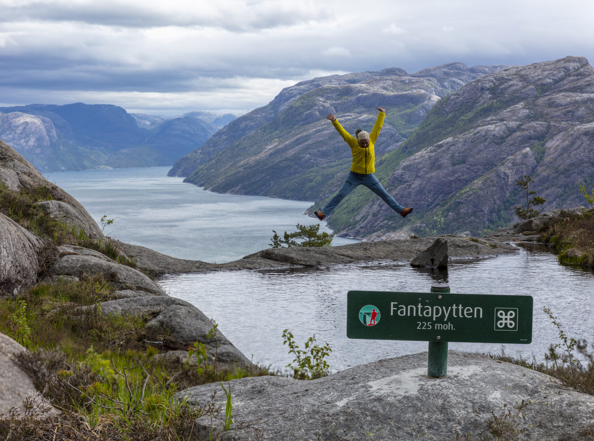
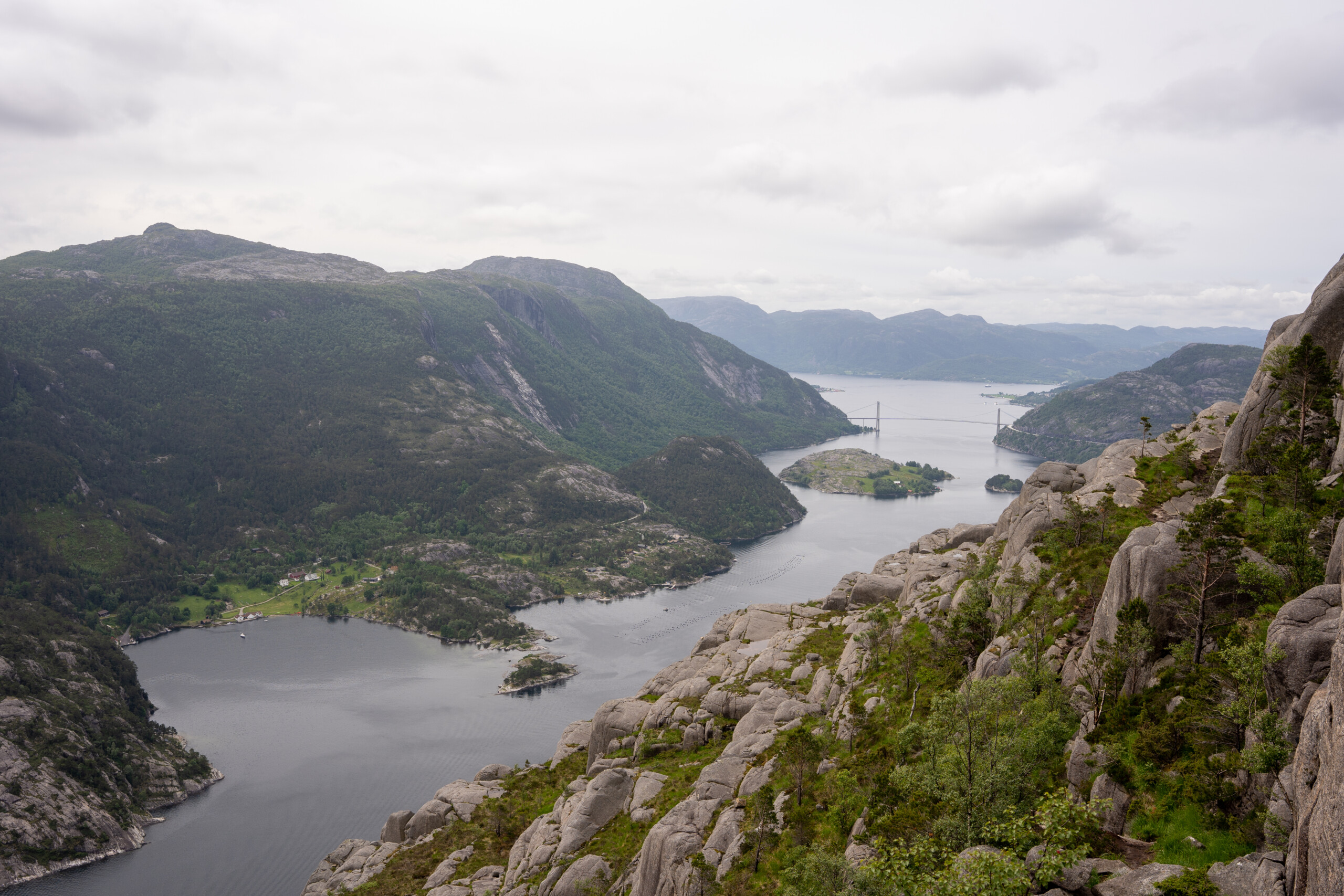
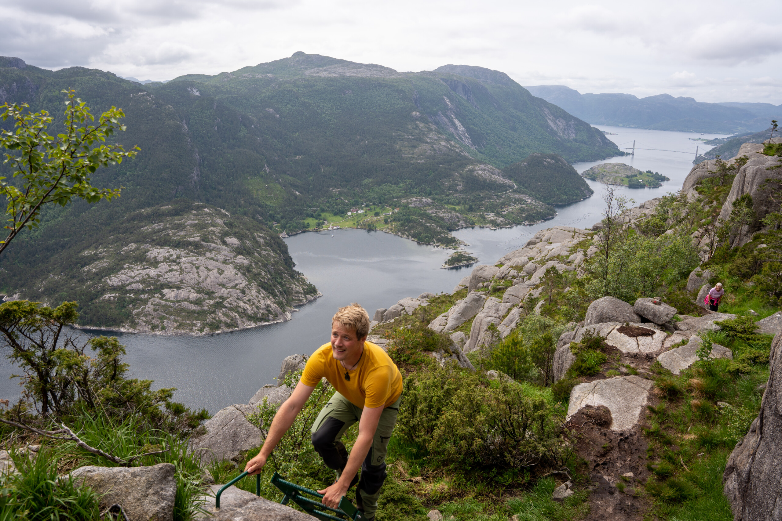
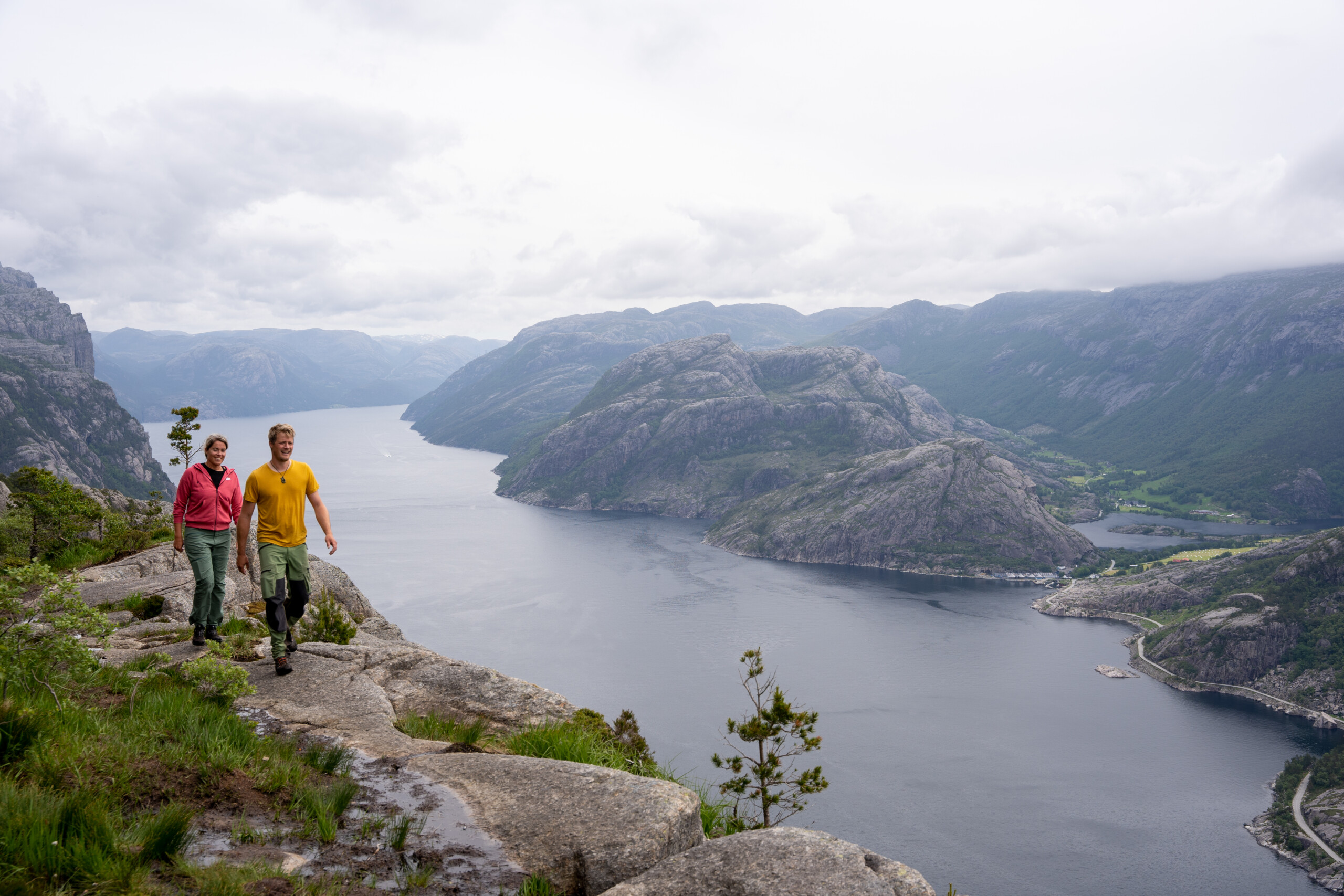
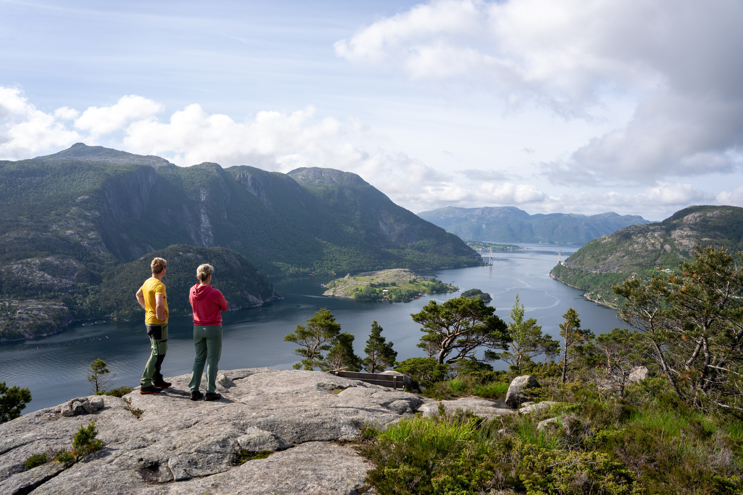
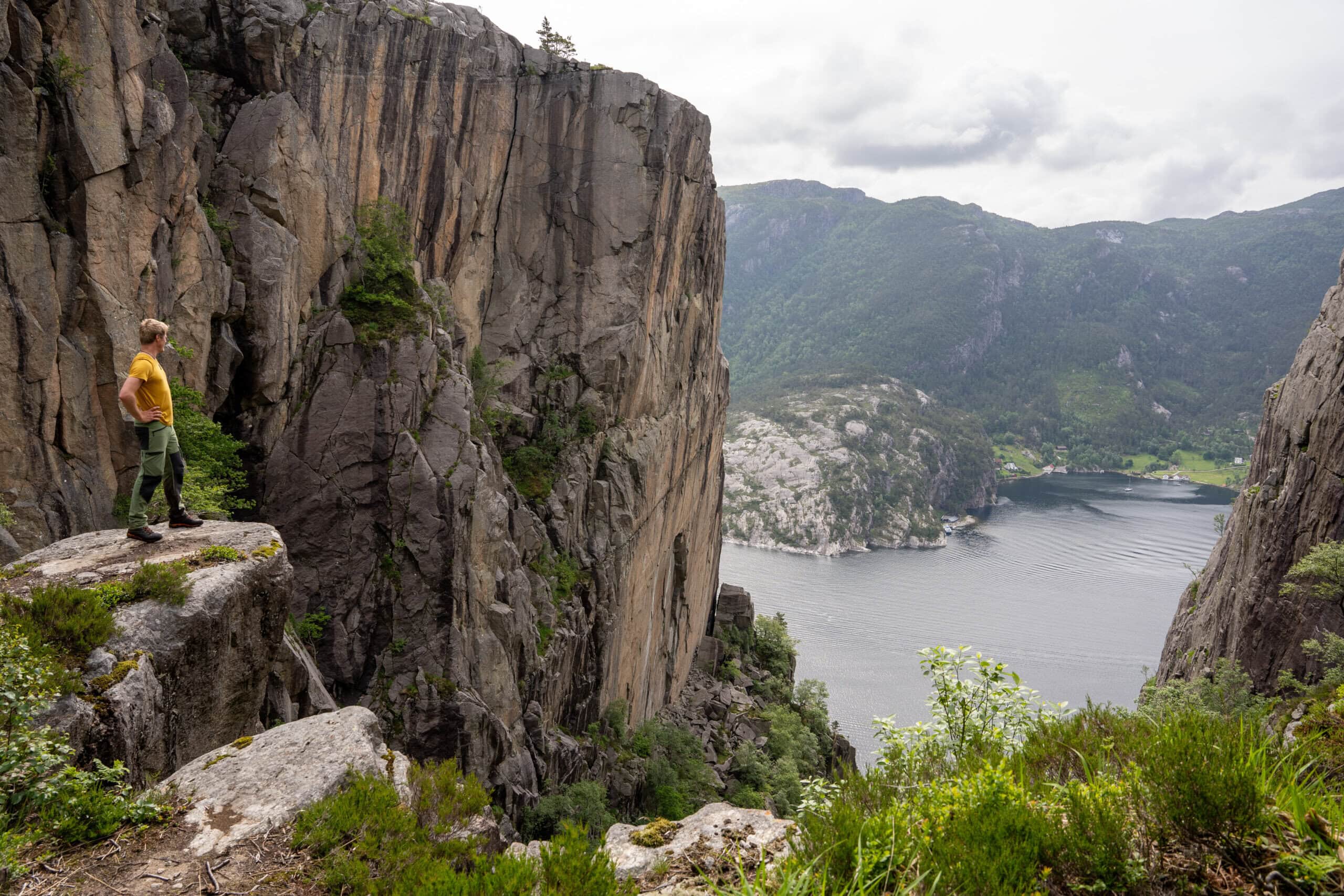

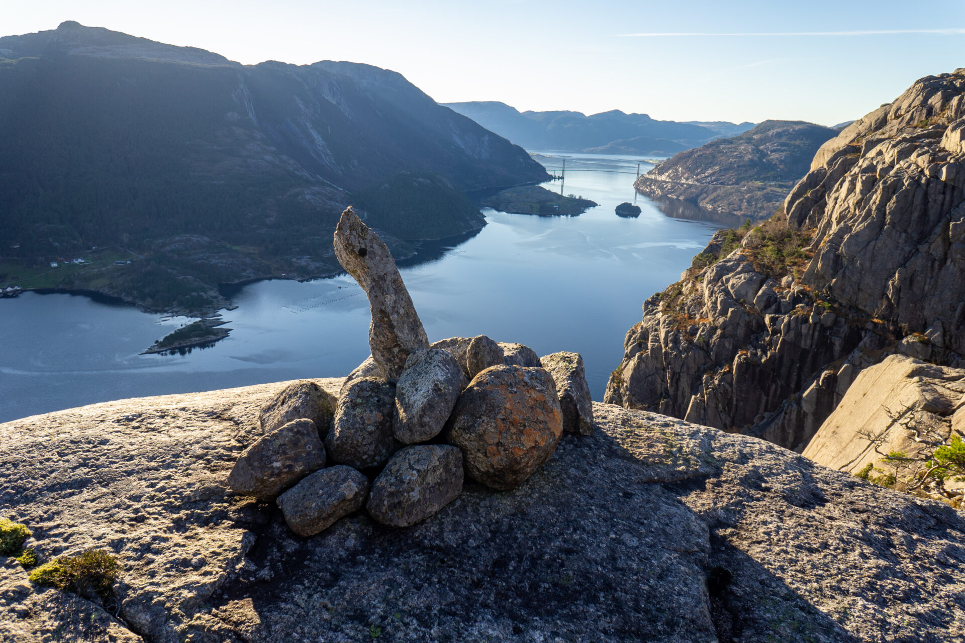


Diese Wanderung wird Sie begeistern! Der Lysefjord Panorama Trail verläuft direkt am Fjord entlang (75%). Vorbei am wunderschönen Revsvatnet und einem dichten Wald erreichen Sie den Lysefjord. Hier schlängelt sich der Pfad Hunderte von Metern über dem Meeresspiegel, entlang mehrerer Felswände und Schluchten, darunter Skjerajuvet und Fantahålå, und durch eine imposante Naturlandschaft mit unzähligen Panoramablicken. Wenn Sie genau hinsehen, entdecken Sie das einzigartige “Fantapytten” – den ‘Infinity Pool’ des Lysefjords.
Die Rückmeldungen aus den Jahren 2024 und 2025 haben gezeigt, dass internationale Wanderer der Lysefjord-Rundwanderung diese Etappe als die schönste empfanden.
Wir empfehlen, den Lysefjorden Rundt Trail gegen den Uhrzeigersinn zu wandern. Es ist jedoch möglich, diese Etappe in beide Richtungen zu wandern.
![]() Auf ut.no, Norwegens Wanderplaner, finden Sie detaillierte Informationen zu Wanderwegen. Nutzen Sie digitale Karten zur Navigation und zur Suche nach Hütten und Wanderungen im ganzen Land. Ut.no ist ein Service des Norwegischen Wandervereins (DNT).
Auf ut.no, Norwegens Wanderplaner, finden Sie detaillierte Informationen zu Wanderwegen. Nutzen Sie digitale Karten zur Navigation und zur Suche nach Hütten und Wanderungen im ganzen Land. Ut.no ist ein Service des Norwegischen Wandervereins (DNT).
NOTIZ Wenn Sie diese Etappe nur als Tagesausflug planen, empfehlen wir Ihnen, von West nach Ost zu wandern, um die beste Aussicht zu genießen. Die sanften, langen Hänge verlaufen ebenfalls ostwärts abwärts (sie fühlen sich beim Wandern in Richtung Westen wie lange Anstiege an), und die steilen Hänge führen ostwärts hinauf (sie sind beim Wandern in Richtung Westen/abwärts etwas ausgesetzt). Lysefjord Panoramaweg für eine Beschreibung von West nach Ost.
Nehmen Sie einen Bus vom Parkplatz Preikestolen zum Ausgangspunkt des Wanderwegs bei Høllesliheia / The Bolder.


| Schwierigkeit | Anspruchsvoll |
| Distanz | 9 km (A→B) |
| Dauer | 4-5 Stunden |
| Gesamter Höhengewinn | 500 Meter (Ost-West) 600 Meter (West-Ost) |
| Jahreszeit | April – Oktober |
| Link zur Wanderkarte | ut.no/preikestolen-basecamp-høllesliheia |
| GPX-Datei | Høllesliheia-Preikestolen BaseCamp (GPX) |

Wegbeschreibung
Sowohl am The Bolder als auch am Preikestolen Parking stehen Parkmöglichkeiten zur Verfügung.
Sie können mit dem Auto anreisen oder einen Bus von Stavanger zum Parkplatz Preikestolen nehmen. Von dort aus können Sie mit dem Bus zum Ausgangspunkt der Wanderung fahren (siehe [Link einfügen]). Öffentliche Verkehrsmittel).
Wenn Sie am Preikestolen-Parkplatz parken, folgen Sie der Beschilderung zum Preikestolen. 9 km von Jørpeland, 17 km von Forsand.
Høllesliheia / The Bolder liegt an der FV 523, 10 km südlich von Jørpeland und 6 km nördlich von Forsand.
Falls Sie lieber auf dem Parkplatz Høllesliheia / The Bolder parken möchten, beachten Sie bitte, dass dort keine Toiletten vorhanden sind. Bitte beachten Sie die örtlichen Hinweisschilder und Anweisungen.
Öffentliche Verkehrsmittel
Bus-Shuttle vom Preikestolen-Parkplatz nach Høllesliheia / The Bolder (Wanderweg)
Neu im Jahr 2026
- Mai–September: Tägliche Busabfahrt um 11:00 vom Preikestolen-Parkplatz nach Høllesliheia / The Bolder
- Oktober: Wochenendabfahrten um 12:00
- Fahrzeit: ca. 15 Minuten
- Preis: 70 NOK
Buchung: Pulpit Rock Touren
Bei der Buchung wählen Sie bitte “Von: Pulpit Rock” und “Nach: The Bolder”.
Preikestolen Ekspress Bus oder Pulpit Rock Touren
Für den Transport zwischen Preikestolen Parking und Jørpeland / Stavanger.
Strandtaxi
Für den Transport zum Bolder und Preikestolen BaseCamp oder um nach Jørpeland oder Forsand zu gelangen.
Planen Sie, den Lysefjorden Rundt Trail im Jahr 2026 zu wandern?
Indem Sie sich registrieren und Ihren Zeitplan teilen, ermöglichen Sie uns, Ihnen Folgendes anzubieten: kostenlose individuelle Beratung Wir prüfen die Machbarkeit Ihrer Wanderroute unter Berücksichtigung von Schwierigkeitsgrad und Logistik. Außerdem erhalten wir Daten zum Besucheraufkommen und zur Wegenutzung, die uns helfen, gezielte Verbesserungen vorzunehmen.
Nach Ihrer Wanderung erhalten Sie einen Feedbackbogen. Wir freuen uns über Ihre Rückmeldung, da diese Informationen für uns unerlässlich sind, um sowohl den Wanderweg als auch das Besuchererlebnis kontinuierlich zu verbessern.
Lysefjord Besucherführer
Während Sie diese majestätische Landschaft erleben, denken Sie daran, dass Ihre Handlungen die Macht haben, unser einzigartiges Reiseziel für alle, die in Ihre Fußstapfen treten, zu schützen und zu bewahren.

Respektiere die Natur

Werde Teil der lokalen Gemeinschaft

Bleib sicher
